
This project goes from 1:100 000 to 1:100 to explore how different needs shape the reading of different scales engaging with the intersection between environmental science, social science and cultural science. Through policy, the project engages with regional planning, municipal planning, city planning, area planning, regulation, design, and management. Through Culture Milieu, culture and nature are two sides of the same coin as Ecological Significant Cultural Practices and Culturally Significant Ecologies are equally important as Heritage Sites, Protected Nature, and Historical/Vernacular Architecture. Romanodromm is therefore a project where designing with ecology, culture and site specificity intersect into strategies that can be applied to derive designs and sites that connect together to a network of locations that accommodates a nomadic way-of-life in Norway.
Romanodromm is an exploration of a national policy to engage the Culture Milieus of the Romani/Tater National Minority
Supervisor:
Others:
Taternes landsforening
Akershus fylkeskommune
Riksantikvaren
Karin Helms
Karoline Frogner
A National Network that empowers nomadic and translocal practices that go across of scales, from the territorial down to the tectonics to describe how different scales engages with the national minority’s needs today and in the future. This project is therefore an assemblage of scales, tying the local to the national through translocality by embodying the lens of a national minority. For us to empower a nomadic culture built on translocality through planning, regulation, maintenance and design, we must understand the specificity of that culture and its relationship to nature. For the Romani/Tater National Minority, whose traveling culture focused on oral transmission of history, that specificity is a dark chapter in Norwegian History.


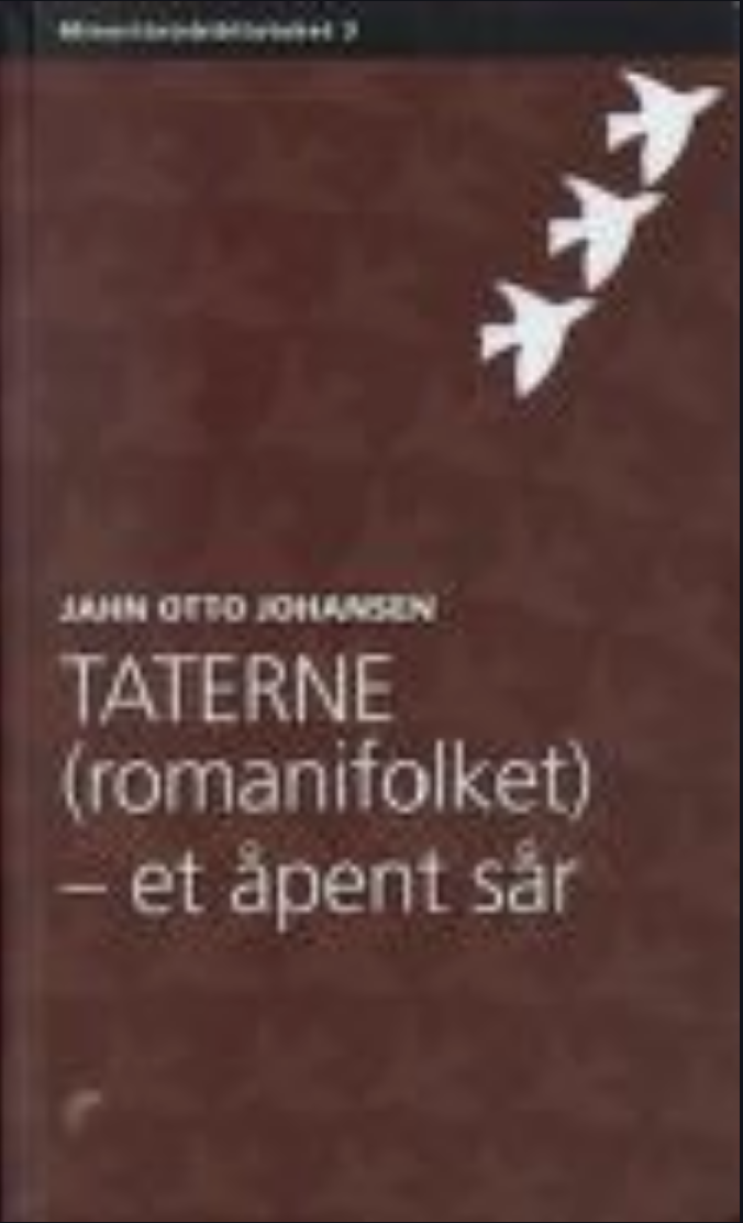


The Romani/Tater Minority were subjected to Genocide by the Norwegian State and erased much of their oral history. The question I posed during this thesis, is whether Landscape architecture can be a tool in reparation, especially after Atrocity? Not only did I find an affirmation—I also discovered that all the tools are already in place within Norwegian Law and planning apparatus. We only need to apply them differently, through a different lens. But in order to apply a different lens, we must understand how Landscape architecture answers to spatial injustice. How Landscapes answer to specificity of Culture and Nature and how spatial injustices are formed through this binary philosophy. And in our case, Genocide is an injustice devised through Spatial, Temporal, and Placial means to target reproduction and any trace of existence, gravely affecting the minority group’s Future.
Further reading into the relationship between Genocide and Landscape can be found in the Pre-Diploma booklet, Nomad Logic-Latjo Drom: On Genocide and Landscape (Contact for more info). The Pre-Diploma booklet applies Deleuze and Guattari’s Treatise on Nomadology from A Thousand Plateaus to read the relationship between Genocide and Landscape. From now on in this abstract, we will engage with the specificity of the Romani/Tater Genocide and how that affected their transmission of culture, history and presence.


The Travelers.
The Romani/Tater National Minority is a hidden chapter in Norwegian history. This is a people who have been subjected to Genocide by the Norwegian State through several policies that targeted their reproduction, their children, and their way-of-life through a eugenic narrative—Vagabondism was considered a genetic mental disorder that racially distinguished the ethnic group. This led to several policies that aimed to disrupt consanguine relationships by dislocating children through orphanages, bans on mobility and trade, dislocation to labor camps and asylums, lobotomy, forced sedentation, and forced sterilization. All these policies were conducted in order to exterminate the group, when Eilert Sundt’s forced assimilation failed. Many of these racist ideas were enhanced during the Nazi Occupation of Norway through 1940-1945. These ideas continued during the Socialist rebuilding of the Norwegian State mainly by Johan Scharffenberg who strongly promoted Sterilization, and these policies were pushed until the 1970s.

Lines of Flight.
Through interviews, seminars and conversations, the project has focused on building a lens to understand the past, the present and the future of the Romani/Tater National Minority. Today’s Romani/Tater people are gravely affected by these brutal policies. As the extermination was failed, small pieces of history and small groups have survived and continue their tradition as craftsmen and musicians, and some of the spoken language remains. And some of the adopted children have rediscovered the past that was taken away from them. For the surviving pieces to sustain itself, it will require more places for encounter within group and with the outside majority. This means that stimulating opportunities to travel plays a central role in sustaining, developing, and communicating this history.
But there also lies opportunities for the new generation of Romani/Tater children who have only experienced indirect impact of the eugenic policies. They have the opportunity to choose their way-of-life, and this agency is the core of this project: the choice to live a nomadic life in Norway. This means that if there is to be a cultural landscape for a nomadic way-of-life, Landscape architects must accommodate for this decision. And that possibility lies latent, as through interviews and conversations, more people are engaging with nomadic forms of culture and choosing nomadic business models.
Policy against Policy.
Culture Milieus [Kulturmiljø] (CM) is a new term coined by the Norwegian Parliament in White Papers 16 (2019-20). The new term combines cultural heritage, landscapes and environments into one definition, and puts forwards management practices and culture that relates to those practices. In this new terminology, CM are not only defined by objects, archeological traces and historical architecture, but also cultural practice, knowledge sharing, and resource management. This means that through this new policy, diversity of landscape management are equally important as historical monuments. The project ties this policy to three other crucial policies that enables us to engage with Landscape Architecture: The Landscape Convention, the Faro Convention, and the EU Framework Convention for the Protection of National Minorities (ETS No. 157). The CM policy answers to the Landscape Convention for biodiversity and landscapes that empower people, the Faro-Convention to highlight the significance of heritage for people, and ETS No. 157 is built on empowering National Minorities through their cultural heritage, practice, and autonomy. Landscape Architecture through this triangulation of policy highlights how cultural practice is a diversity of stewardship of nature, and how central Ecology then plays into cultural practice and diversity of autonomous modes to engage with the landscape. Ecologies are therefore equally central to Culture, as it highlights how one can design and build autonomy and diversity through Culturally significant Ecologies and Ecologically Significant Cultural Practices. By strengthening cultural practices and building projects that empower national minorities, you then also empower rare and unique ecologies, and vice versa. For National Minorities, Fringe Ecologies and Fringe Practices are therefore a crucial key to understanding how Landscape Architecture contributes to building diversity for both culture and nature, where CM blurs the line set by sedentary societies.


1 : 100 000. Fringe Culture, Fringe Ecology.
For our intents and purposes, the Fringe Ecology that ties together with the Romani/Tater people is their need for encampment on travel, historically and at present. Throughout the thesis, the work has centered on registered CMs that are publicly accessible, but conversations with Akershus County reveals that many more have been registered waiting to be published. Many of the CMs are along the shoreline or along the forest edge. For this thesis, we will focus on the ones in-land, knows as Tater Meadows [Liggesletter/Tatersletter], camping sites that have historical and present significance to this National Minority. As a culture dependent on Sedentary Economies in order to engage with trade, craft and entertainment, the Encampments were on the periphery of settlements. This Peripheral condition is two-folded: Firstly, it was at the edge of the settlement, often forest edge to agriculture that could not be appropriated into the sedentary economy because it would not benefit agriculture or agroforestry; Secondly, the condition of the site had to be ample for encampment based on their mode of mobility, cover from weather, and quickly dry with fast infiltration. This means that dry Fringe Ecologies are symbiotic with the Romani/Tater cultural practice of encampment, gathering and foraging materials from those sites. To limit the scope of the thesis, the project area focuses on the Glomma Watershed. Glomma River is the longest river within Norway’s national boundaries, making it the clearest in-land landscape entity for travel across the land with the largest coverage of soil for agriculture and agroforestry. The Watershed is also the territory with the highest concentration of documented Romani/Tater CMs due to this, and has many ecological specificities as an in-land valley system. Glomma is mainly distinguished by the separation of upper and lower segments due to an old glacial ridge, which means that the lower segments are distinguished by flooding events during the Ice Age, a unique soil condition in Norway.

1 : 50 000. Peripheral Condition.
For this project, we will look at Elverum municipality because of the highest amount of registrations of Romani/Tater CMs within the Glomma Watershed. The municipality is centralized in the town where many old roads passed through leading to the top of Glomma, Rørøs, Norway’s cultural center for craftsmanship, and folk music. The Elverum Landscape is distinctly shaped by the Flooding Events during the Ice Age, shaping sand terraces that were carved away by the River Dynamics over time. This means that Elverum’s locality is especially defined by layers of sand across the elevation as it was carved out by Glomma river underneath an ice sheet. At the bottom of the valley are river deposits, then the floodings of sand and silt, then glacial till before the top of the watershed and the plateaus are distinguished by bog systems. The river introduces soil from further up the watershed, which is characterized as calcareous sedentary bedrock. This valley is also positioned at the weather gradient between oceanic and continental sections as well as having south boreal features with microclimates resembling boreonemoral and middle boreal conditions. The ecological societies are therefore defined by these gradients territorially, with a diversity of pockets for niche and fringe ecologies. What is particularly interesting part of this territory are the wind deposits that distinguishes Elverum’s valley systems.

1 : 25 000. Plan Rhizome.
Our focus will be dwelving into Elverum Town, as the site of interest is tied directly to the specific geology of this territory; the sand pits across Elverum Town. Plan Rhizome proposes a landscape structure over Elverum that highlights the sand terraces shaped by the River Dynamics as edges to define planning. For this reason, the furthest extent of the plan is the edge of the Flood deposits, then subdivided by the most distinct terraces in the topography as edges for urban planning. The plan highlights how CM are defined across cultural and ecological categories, where significant urban structures, river edges and waterways are included in the plan. Additionally, ecologies that are specific to the territory are also added to the plan, such as bogs and wind deposits. The sand pits are in a ring that follows the main terrace that subdivides the eastern side of the plan, going into the wind and flood deposits that form this terrace. Important roads also trace the line of this terrace before cutting through to exit Elverum’s town border.

1 : 10 000. Liminal Edge.
Our Plan Rhizome firstly proposes planting along this terrace to reinforce the soil from erosion with root networks. But secondly, the plan also ties together all the CM into one cohesive structure, a liminal forest edge, to highlight the significance of these environments in recording human history on this territory. And lastly, as a subdividing edge of the landscape, it marks the boundary before the forest edge, creating opportunities for appropriation, planning for alternating zoning over time, and can host a diversity of practices to use this edge. This shifting multiplicity of human use reflects the specificity of the landscape, allowing both ecological societies to diversify through alternating management practices, as well as cultural practices to experiment and develop over time in engagement with nature. What this describes to us is that the zoning past this subdivision should reflect a larger biomass than built environment, connecting gardens of sprawl housing together with CM to create, on one hand, an underground system that can host biodiversity through the roots system, and on the other host cultural diversity on top of the soil through management practices as a framework. This Liminal Edge Framework reveals to us a gradient from the city center to the forest edge, highlighting a deeper relationship between Ecology and Culture as a growing palimpsest.


1 : 1 000. Translocal Programming.
Within the planning area, the plan highlights the relationship between zoning, programming and appropriations. With the Sandpit next to the school and kindergarden, we can achieve several goals that tie back to the Romani/Tater National Minority while also empowering appropriation by the locals through Wilderness Policies [Allemannsretten]. Firstly, the Romani/Tater National Minority and those who choose the traveler’s way-of-life, school facilities can provide amenities like showers, internet and temporary community spaces, as well as facilitating remote learning for traveling families. At the same time, since Travelers represent a minority, the locals can also be empowered through appropriation through Wilderness policy if we allow the boundary of Wilderness to be drawn further towards the city from the Elverum’s periphery. This regulation proposal recontextualizes suburban edges, forest edges and peripheral industries into a social and ecological web, letting the liminal edge be a host for alternating uses over time and develop places that engages travelers and locals.

Vegetation Structure.
The conditions of the sand forest ecology are very specific in this area; the canopy consist of mainly climax succession, in this case Scots Pine (Pinus Sylvestris), with almost no understory. The surface cover remains first succession vegetation like mosses, lichen and berries from the shifting sand preventing soil development and humus accumulation. This means that what sustains sand forest ecology is a Rhizome of Pine tree roots that supports the water distribution in the Ecological society for primary succession plants to establish while the top soil is constantly disturbed. This combines well with conditions for encampment; dry, flat and sheltered. And camping pairs with the ecology by disturbing the top soil. For us, this means that the Vegetation structure for the sand pit primarily needs to accommodate human use and soil disturbance, while also allowing slow-growing pines to establish over time. Wildflower and wildgrass mixes can be planted to initially cover the topsoil, preventing it to be washed our and dried in the initial phases of the project. The vegetation concept is then hedges that protect against the wind, which lends Hanging Birch (Betula Pendula) ideal for hedge planting perpendicular to the wind direction, and spaces in between the hedges to form alternating campsites for caravan (heavy) and tent (light). When it is not used by travelers, it can be a park that allows for recreation and markets when in season. Clusters of Pine are planted in the lighter use zones, allowing it to self-propagate and spread over time.


1 : 200. Management and Succession.
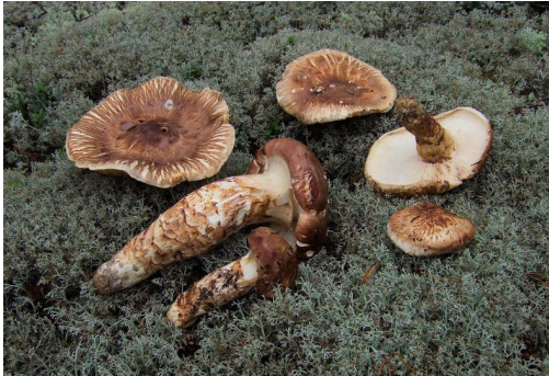
The maintenance of this place is therefore directly linked together with the cultural practice of camping and disturbing the sandy soils. Zones planned for heavy use can divert water to the areas with less use, and over time as the Pine trees grow, the heavy use will dominate the shrub layer and ground cover conditions through compaction. But as it is sandy soils, compaction has little impact on the soil density, allowing it to be shuffled. Within 100 years, a Pine forest will have developed with a limited understory, and the exposed top soil in the heavy camping areas will have developed mosses, lichen and berries that can spread into the light camping areas. This means that the Pine forest ecology will over time establish itself symbiotically with human use. With this development, key species within Sand Pine forests will emerge, such as bugs, bacteria and yeasts. But most importantly are the diversity of mushrooms that will grow on deadwood and in the soil. These mushrooms are dependant on establishing a Mycorrhiza with the Pine trees, mosses and lichens, growing rare species that can be foraged as seasonal foods that can incorporate into local and translocal cultures together with the timber from maintenance. Culture develops together with the Ecology, challenging the very notion of nature separate from culture as we move towards Convivial Societies. We just need to rekindle the motions, both socially and ecologically.




1 : 100. Encounter Place.
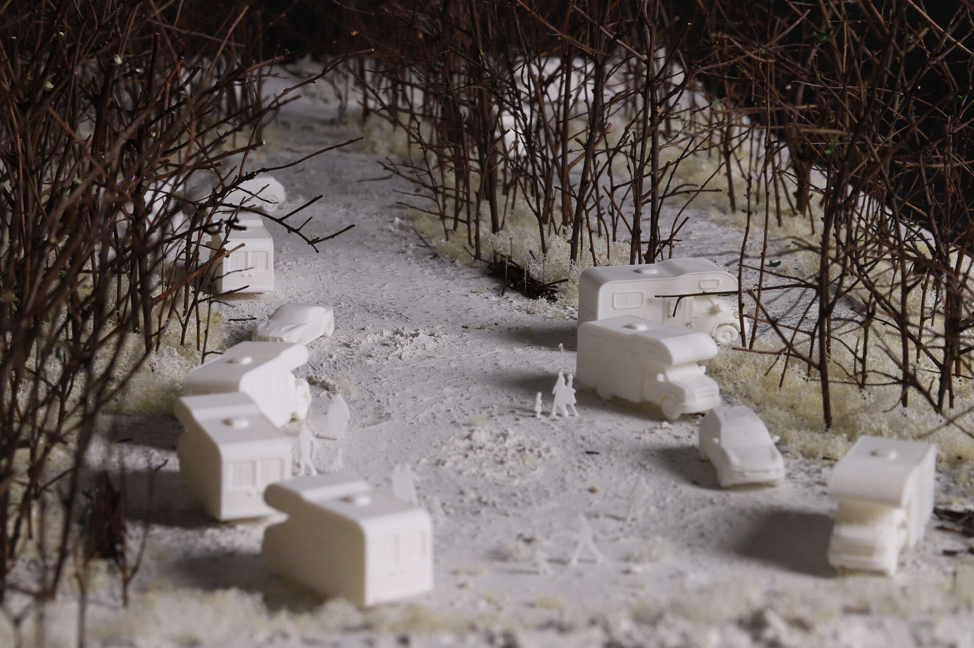
Encounter is the most important concept in this policy. What lessens stigma, allows culture to be exchanged, developed and flourish lies in encounter with diversity; encounter with ecology, encounter with different ways of life, encounter with different experiences. These camping parks are therefore more than their individual parts. This National Policy proposes a network of camping sites built on Culture Milieus that stimulate a traveling way-of-life across Norway drawn from encounter with locality—its people, its culture, its ecology. These experiences are not the spaces themselves, but the people who use them. Encounter Places build on allowing culture and nature to emerge from symbiosis of many different paths of life through common use. Even a trailer park ties to a larger whole regardless of your background, where you can gather and exchange knowledge and experiences.



The Beginnings of a National Policy can therefore be understood from the points above.
Landscape Architecture can plan for repairing after Atrocity through policy by empowering a diversity of significance, cultural and ecological. But the policies must be built around Commons and Conviviality, human use in symbiosis with ecological conditions, and that one can build culture from local to national by accounting for translocal cultures. Culture Milieu policies allow for this type of planning as shown through this case study. Building National Policies reflect the shared ideas of our landscape. A diverse landscape tends to its specificities, and tends to encounter across specificities. Romanodrom is a study in conviviality as much as it is a study of justice, and perhaps in the future, we can grow Post-Genocide Societies together. Where we don’t forget, but we have forgiven.

The project was awarded Honors of Excellence and nominated to Excellence in Spatial Layout by Vestre.
Contact

Jan Trinh is a Vietnamese-Norwegian landscape architect+architect who works by translating theory and design across architecture, landscape, art, and urbanism. Combining cultural science, social science, and environmental science, Trinh develops projects across of scales from territorial to tectonics depending on scope and needs. Through this triangulation of competencies, Trinh engages with how different ways-of-life, cultural practices and minority work informs planning, design, and policy. Through this education, Trinh has specialized in working with National Minorities, Indigenous People, Diaspora, and Intersectional Minorities.